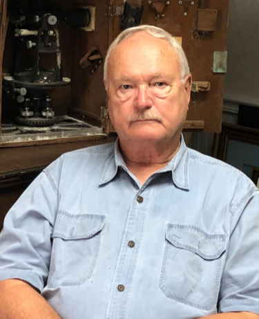
PETER ANDERSEN, PSM
Professional Surveyor and Mapper
VICE PRESIDENT - GCY, INC.

EDUCATION
- Catonsville Community College, Catonsville, Maryland
- Indian River Community College, Ft Pierce, Florida
- Undergraduate Curriculum, Surveying
- International Correspondence Schools – Civil Engineering Curriculum
PROFESSIONAL REGISTRATIONS AND CERTIFICATIONS
- Professional Surveyor and Mapper, State of Florida License No. 5199 since February 1993.
- LEICA HDS Scan Station High Definition Scanning Training-Norcross, Georgia - 2009
- Trimble GP Survey Software Customer Site Training
Trimble RTK Training, San Jose, California - 1995 - GLO Retracement & Restoration of Original Corners – 2000, 2005
- NGS Blue Book Training – Horizontal and Vertical
AFFILIATIONS
- Florida Surveying and Mapping Society, Indian River Chapter
- Treasurer 1998-1999
- President 2002-2003
- Florida GPS Users Group
- Martin County Chamber of Commerce
- National Society of Professional Surveyors
SURVEYING CAREER
- Began surveying in 1970 with a small company in Baltimore, Maryland.
- Served in the US Navy Reserves from 1971 to 1977 with active duty occurring in 1971. Honorably Discharged in March 1977.
- Went to work surveying for a larger survey firm also in Baltimore, Maryland from 1972 to 1977.
- Moved to Florida in 1980 and began working for the Richard L. Sheppard Surveying firm and continued there through 1983.
- Worked for Biscayne Engineering and Surveying out of Port St. Lucie office until December 1984 when I started with the newly established firm of GCY, Inc.
PRINCIPAL AREAS OF PRACTICE
- Boundary Surveys from Residential Lot to 108,000 Acre +/-
- ALTA/NSPS Land Title Surveys
- FDEP Acquisition Surveys
- FDEP Submerged Land Lease Surveys
- USDA/WRP Easement Acquisition Surveys
- USDA/WRP Easement Retracement Surveys
- USFWS Acquisition Surveys
- Geodetic/GPS Control Surveys – Horizontal and Vertical
- Mean High Water Surveys
- Subdivision Platting
- Topographic Surveys
- Hydrographic Surveys
- As-Built Surveys
- Quantity Surveys
- Construction Surveying
